Mapping Population Health: How the Maritime Health Atlas is improving health care planning
Health research and health care planning are challenging enterprises. When a province or territory sets out its health-related goals, success depends on many factors, including the ability of decision-makers to take a comprehensive view based on sound data – of a community, region, or the entire province.
Traditionally, much of this health research and health care planning has been done using postal codes to identify geographic locations of health events and services, as postal codes are routinely collected for population surveys.
As it turns out, however, postal codes are best used for mail delivery, not health care delivery.
Many postal codes – particularly those in rural areas – cover geographically enormous areas, making it impossible to pinpoint individuals with specific service needs. They also cover areas that cross various administrative boundaries (such as census tracts, electoral districts, and counties), making them useless for determining where resources should be allocated.
In response to this challenge, the Maritime SPOR SUPPORT Unit (MSSU), in collaboration with the provincial governments, health authorities, and universities, developed the Maritime Health Atlas – an online tool that allows health researchers and health care decision-makers to gain a better picture of the health characteristics of the population, what their needs are, and how best to support them.
Dr. Mikiko Terashima, an assistant professor at the School of Planning and the Department of Community Health and Epidemiology at Dalhousie University, worked with the MSSU to develop the Maritime Health Atlas. “If you use the postal code approach to allocate resources and services, you’re most likely going to be putting services in the wrong place – especially in rural areas, which tend to be the high-needs areas,” said Dr. Terashima. “So our goal was to find a better way – to create an atlas that provided a clear and accurate picture of the health resources and health needs of a given region or province.”
Supported by the Strategy for Patient-Oriented Research (SPOR) – a partnership between the Government of Canada and the provinces and territories – the atlas is a free resource that is available to everyone.
While the project is still in its early stages, the atlas is already helping decision-makers to more clearly see how factors such as chronic disease prevalence, high-cost health care, and physician costs vary across regions.
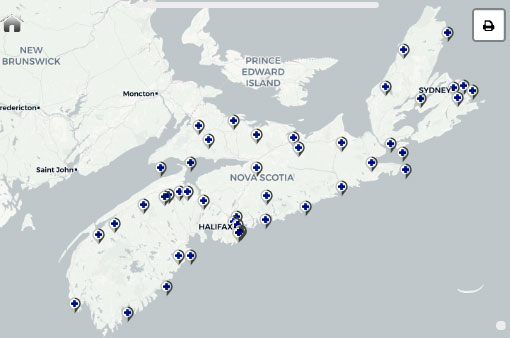
The atlas currently includes data for Nova Scotia and New Brunswick and will soon be expanded to include data for Prince Edward Island. In addition, the team is looking to further broaden the platform by developing a database that will serve an even a wider range of users, including those community and patient groups in greatest need of resources and support.
“This investment from SPOR has produced a tool with the capability to transform health research and health care planning,” added Dr. Terashima. “There are a lot of challenges with operationalizing such a large enterprise with so many stakeholders, but the breadth of this project makes it all the more exciting. The Maritime Health Atlas has a bright future and has the potential to really make a difference in the health of the Maritime population.”
What is SPOR?
The Strategy for Patient-Oriented Research (SPOR) is a collection of funding partnerships between the Canadian Institutes of Health Research, provinces and territories, philanthropic organizations, academic institutions, and health charities. At its core, SPOR is about providing the evidence needed to inform the development of health policies and improve the health care system. It is about putting scientific discoveries into practice, and producing the information decision-makers and health care providers need to improve patient care.
More information on the Maritime SPOR SUPPORT Unit.
- Date modified: